How can using offline maps help hikers when navigating the Torrent de Pareis trails?
Similar Topics
offline maps
torrent de pareis
hiking navigation
serra de tramuntana
mallorca trails
gps integration
trail safety
topographical details
Using offline maps can be an invaluable resource for hikers navigating the Torrent de Pareis trails, especially given the remote and rugged nature of the landscape. This area, located in the Serra de Tramuntana in Mallorca, is well known for its dramatic gorge scenery and challenging paths, where mobile network coverage is often unreliable or non-existent. By downloading maps ahead of time, hikers ensure they have continuous access to detailed trail information without depending on an internet connection. This can provide reassurance and enhance safety, allowing hikers to track their position accurately, identify key landmarks, and make informed decisions about their route.
Offline maps also offer a level of reliability that printed maps may lack, as they often include GPS integration and can be updated regularly with the latest trail conditions and points of interest. In a terrain like the Torrent de Pareis, where navigation through narrow canyons and variable elevations can be complex, having precise, real-time location data can prevent hikers from losing their way or straying onto dangerous paths. Moreover, offline maps tend to include essential topographical details, such as elevation changes and water sources, which are critical for planning rest stops and managing energy levels throughout the hike.
Another advantage of using offline maps is the convenience and weight savings compared to carrying multiple paper maps or guidebooks. With a smartphone or a GPS device loaded with offline trail maps, hikers can access all relevant navigation data in one place, enhancing both comfort and ease of use on the trail. Additionally, many offline mapping apps allow users to mark waypoints, track their progress, and share their location with others, which adds a layer of communication and emergency support in case of unexpected difficulties.
In summary, leveraging offline maps when hiking the Torrent de Pareis trails supports safer, more informed navigation in a challenging environment where connectivity is limited. It facilitates better route planning, helps hikers stay oriented, and ensures access to essential trail information regardless of signal availability. For anyone exploring this stunning yet demanding natural area, offline maps are a practical tool that can significantly enhance the overall hiking experience.
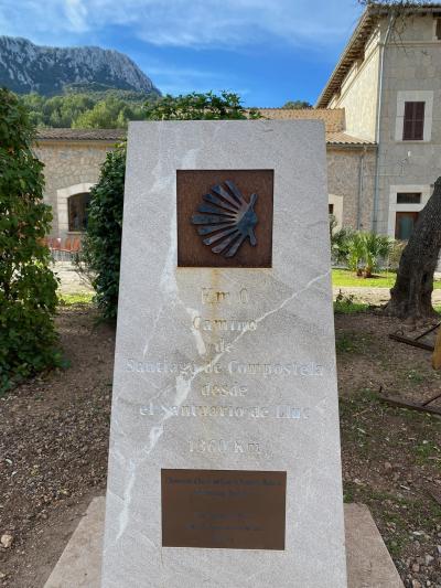
Sanctuary of Lluc
More Fotos


🧩 Related Questions
Related Question
Are there any festivals in Mallorca that highlight the island’s religious or spiritual heritage?
Related Question
How do online reviews help in selecting a reputable certified tour guide in Mallorca?
Related Question
How can travelers tell the difference between a genuine ensaimada and a commercialized version?