How important is it to carry a GPS device or map when hiking in Mallorca’s remote gorges?
Similar Topics
mallorca hiking safety
gps device hiking
hiking navigation tools
remote gorges mallorca
hiking map mallorca
offline gps hiking
challenging terrain mallorca
hiking route planning
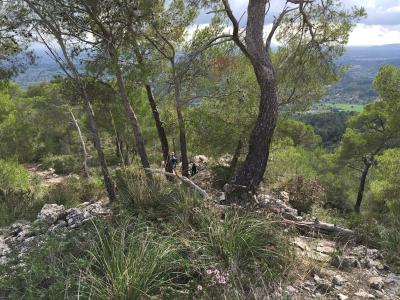
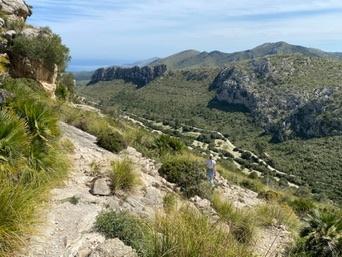
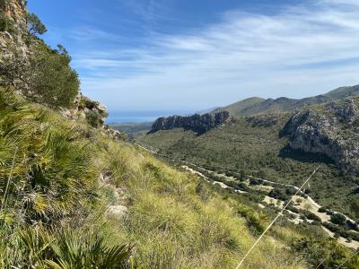
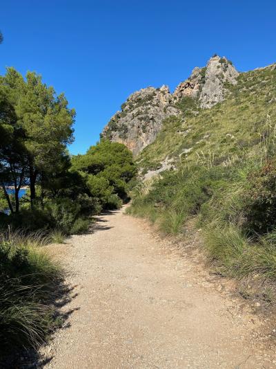
Carrying a GPS device or a detailed map when hiking in Mallorca’s remote gorges is highly advisable due to the island’s varied and sometimes challenging terrain. While Mallorca is well-known for its scenic beauty and well-marked routes in popular areas, many of the gorges, such as Torrent de Pareis or Gorg Blau, can be quite isolated and complex. Trails often wind through steep cliffs, dense vegetation, and rocky landscapes, which can make navigation difficult without reliable tools. A GPS device or map helps ensure that hikers remain oriented and can safely find their way, especially in poor weather conditions or low visibility.
Moreover, mobile phone signals in these remote areas can be inconsistent or completely absent, making it unsafe to rely solely on smartphones for navigation or emergency contact. Having a physical map or a GPS unit with offline capabilities provides reassurance and can be crucial in case of unexpected detours or if one needs to backtrack. It also allows hikers to plan their route in advance, estimate distances, and identify landmarks, contributing to a more confident and enjoyable experience. Given the potential hazards of uneven ground and sudden changes in trail conditions, proper navigation tools are essential for both safety and peace of mind.
While some experienced hikers might feel comfortable navigating using local knowledge or intuition, visitors unfamiliar with the region’s landscape should especially prioritize carrying navigation aids. In addition, informing others of your planned route and estimated return time can enhance safety. In summary, the importance of carrying a GPS device or map when exploring Mallorca’s remote gorges cannot be overstated—it is a key precaution that supports safe, responsible, and fulfilling hiking adventures on the island.
Cala Figuera
More Fotos


🧩 Related Questions
Related Question
What educational opportunities exist for travelers to learn about Mallorca’s native plants through community programs?
Related Question
How does the Statute of Autonomy for the Balearic Islands affect Mallorca's local government powers?
Related Question
What support is available specifically for minors and adolescents who have experienced psychological oppression in Mallorca?