How do Mallorca's geographical features impact transportation and travel around the island?
Similar Topics
mallorca transportation
serra de tramuntana
winding mountain roads
flat terrain travel
palma airport
public transportation mallorca
coastal ferry services
mediterranean island travel
Mallorca’s diverse geographical features significantly shape transportation and travel around the island, influencing both accessibility and the overall travel experience. The island is dominated by the Serra de Tramuntana mountain range on its northwest side, which creates a rugged terrain with steep slopes and narrow, winding roads. This mountainous area restricts the development of wide, straight highways, making travel slower but more scenic. Drivers navigating this region often encounter tight switchbacks and tunnels, which require cautious driving, especially in adverse weather. However, this also enhances the sense of adventure and offers breathtaking views, attracting tourists willing to explore beyond the more accessible coastal areas.
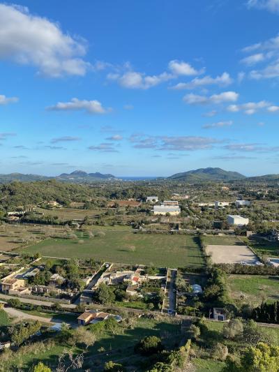
In contrast, the central plains and southern regions of Mallorca are relatively flat, enabling easier and faster travel on well-maintained roads and highways. These flatter areas accommodate a more extensive network of roads, facilitating convenient connections between towns and tourist destinations such as Palma, the island’s capital. Public transportation, including buses and trains, operates more efficiently in these less rugged zones, providing reliable options for visitors and locals alike. The flat terrain also supports significant airport infrastructure near Palma, ensuring good connectivity to mainland Spain and Europe.
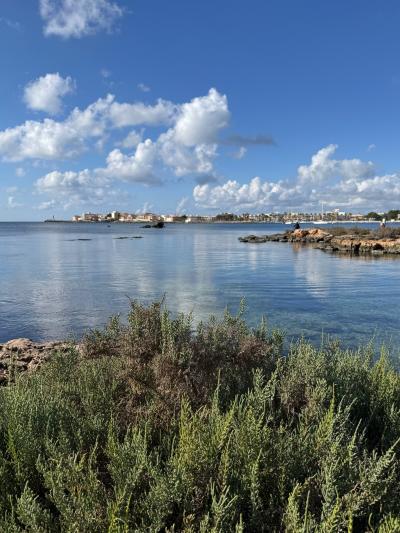
Additionally, Mallorca’s extensive coastline and numerous small bays require frequent ferry services and marinas, linking coastal towns and supporting water-based travel. The island’s natural harbors accommodate ferries that connect Mallorca to neighboring Balearic Islands and the Spanish mainland, supplementing road and air transport. Coastal geography thus adds an important maritime layer to the island’s transportation system, especially useful for touristic excursions and regional connections. Overall, Mallorca’s varied geography demands a flexible transport system that combines mountain roads, coastal ferries, and efficient urban transit to meet diverse travel needs across the island.
In contrast, the central plains and southern regions of Mallorca are relatively flat, enabling easier and faster travel on well-maintained roads and highways. These flatter areas accommodate a more extensive network of roads, facilitating convenient connections between towns and tourist destinations such as Palma, the island’s capital. Public transportation, including buses and trains, operates more efficiently in these less rugged zones, providing reliable options for visitors and locals alike. The flat terrain also supports significant airport infrastructure near Palma, ensuring good connectivity to mainland Spain and Europe.
Additionally, Mallorca’s extensive coastline and numerous small bays require frequent ferry services and marinas, linking coastal towns and supporting water-based travel. The island’s natural harbors accommodate ferries that connect Mallorca to neighboring Balearic Islands and the Spanish mainland, supplementing road and air transport. Coastal geography thus adds an important maritime layer to the island’s transportation system, especially useful for touristic excursions and regional connections. Overall, Mallorca’s varied geography demands a flexible transport system that combines mountain roads, coastal ferries, and efficient urban transit to meet diverse travel needs across the island.
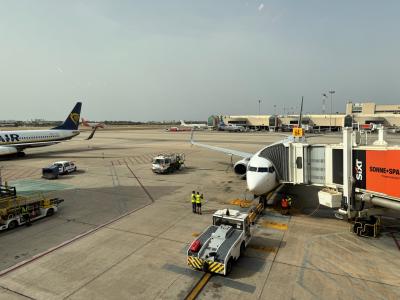
Palma de Mallorca Airport
More Fotos


🧩 Related Questions
Related Question
How are social media campaigns used to inform tourists about waste management and recycling in Mallorca?
Related Question
How do Mallorca's geography and climate factor into the viticulture policies?
Related Question
How do Mallorcan government and institutions handle official records considering the diversity of surnames?