How can I follow the hiking trails around the Serra de Tramuntana without getting lost?
Similar Topics
hiking trails
serra de tramuntana
trail markers
gr221 path
valldemossa hiking
soller walks
mallorca maps
hiking apps
Trail navigation becomes especially important during spring and autumn when the Serra de Tramuntana draws walkers eager to enjoy cooler temperatures and stunning mountain views. Most well-trodden paths between towns like Valldemossa, Deia, and Soller are marked with colored blazes painted on stones or wooden posts. These guideposts usually correspond to specific routes, such as the GR221, helping hikers stay on course through pine forests and terraced olive groves.
At key junctions you will often find wooden signage offering distances to nearby villages or landmarks, which is invaluable if you want to estimate how far you have to walk before reaching your next stop or a refreshing café. While this network of signs is quite reliable, some less frequented ramblas and forest trails may have fewer markers, especially off the main hiking seasons.
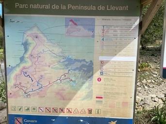
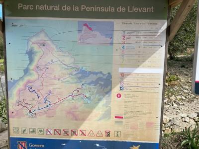
It’s wise to carry a detailed map of the Ma-10 road area or use apps with offline trail maps to complement the physical markers — mobile signal can be patchy in the more rugged parts. Local hiking groups or guesthouses in towns like Pollenca or Alcudia often provide useful advice and updates about trail conditions.
Relax and take your time while exploring these paths; the combination of thoughtfully placed markers and your own sense of direction will make for a memorable journey. Pause to admire the fragrant rosemary and sip a cool Hierbas, and remember that sometimes the most rewarding discoveries lie just a short detour off the beaten track.
At key junctions you will often find wooden signage offering distances to nearby villages or landmarks, which is invaluable if you want to estimate how far you have to walk before reaching your next stop or a refreshing café. While this network of signs is quite reliable, some less frequented ramblas and forest trails may have fewer markers, especially off the main hiking seasons.
It’s wise to carry a detailed map of the Ma-10 road area or use apps with offline trail maps to complement the physical markers — mobile signal can be patchy in the more rugged parts. Local hiking groups or guesthouses in towns like Pollenca or Alcudia often provide useful advice and updates about trail conditions.
Relax and take your time while exploring these paths; the combination of thoughtfully placed markers and your own sense of direction will make for a memorable journey. Pause to admire the fragrant rosemary and sip a cool Hierbas, and remember that sometimes the most rewarding discoveries lie just a short detour off the beaten track.
More Fotos