Are there maps or apps that show toll roads and costs on Mallorca?
Similar Topics
mallorca driving
toll roads
ma-10 road
ma-19 route
google maps mallorca
waze mallorca
tib bus mallorca
local transport
Locals rarely worry about toll roads here since Mallorca doesn’t have them, which means no extra charges for driving between towns. Navigating routes like the scenic Ma-10 through the Serra de Tramuntana or the coastal Ma-19 to Cala Mondragó is straightforward with standard maps or GPS apps. While you won’t find tolls, it’s still useful to have a detailed map or app to explore lesser-known coves such as Cala Llombards or plan a trip up to Formentor, especially if you want to avoid traffic on narrow roads.
Popular navigation apps like Google Maps and Waze work well across the island, offering real-time traffic updates and helpful route suggestions. The TIB bus network also provides accurate digital timetables if you’re using public transport to visit Palma, Sóller, or Manacor. Although you don’t need to budget for toll costs, keeping an eye on time can make your journey smoother, particularly during busy summer months or popular festivals like Sant Sebastià in Palma.
For offline use, local tourist offices in towns such as Alcúdia or Pollença provide paper maps, including hiking trails in Valldemossa and Deia. These can complement your digital tools, giving you a tactile reference when exploring beyond the main roads. Whether driving to the white sands of Es Trenc or cycling the Tramuntana passes, digital and paper maps remain your best companions rather than worries about tolls or fees.
Popular navigation apps like Google Maps and Waze work well across the island, offering real-time traffic updates and helpful route suggestions. The TIB bus network also provides accurate digital timetables if you’re using public transport to visit Palma, Sóller, or Manacor. Although you don’t need to budget for toll costs, keeping an eye on time can make your journey smoother, particularly during busy summer months or popular festivals like Sant Sebastià in Palma.
For offline use, local tourist offices in towns such as Alcúdia or Pollença provide paper maps, including hiking trails in Valldemossa and Deia. These can complement your digital tools, giving you a tactile reference when exploring beyond the main roads. Whether driving to the white sands of Es Trenc or cycling the Tramuntana passes, digital and paper maps remain your best companions rather than worries about tolls or fees.
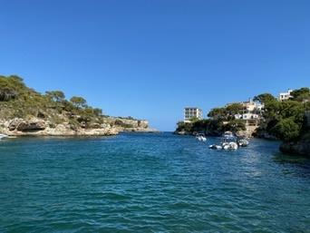
Cala Figuera
More Fotos