How can I best navigate Mallorca’s roads if I’m not familiar with the island?
- Mallorca roads
- Serra de tramuntana
- Ma-13 road
- Tib bus
- Soller railway
- Local driving tips
- Cala mondrago
- Pa amb oli
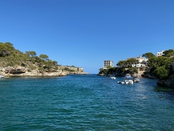
Driving on Mallorca’s winding roads, especially the narrow stretches through the Serra de Tramuntana, is easier when you plan your route in advance. Reliable GPS apps like Google Maps or Waze work well here, offering real-time traffic info that’s useful along major routes such as the Ma-13 and Ma-19. Keep in mind some rural paths and mountain roads can be tight and challenging, so driving at a moderate pace is wise. Picking up a detailed road map alongside your digital tools can help you get a clearer grasp of where towns like Sóller, Valldemossa, or Pollença sit in relation to beaches like Cala Mondragó or Formentor’s peninsula.
If you prefer not to drive, the extensive TIB bus network connects many towns with the capital Palma and popular spots, though buses can be less frequent off-season. The charming Sóller railway offers a scenic alternative between Palma and Sóller through the Tramuntana foothills. Pay close attention to local road signs and watch for unexpected mountain bends and agricultural vehicles, especially on rural roads. Don’t hesitate to stop and ask locals for directions—residents are often happy to share insider tips on less-trafficked routes or hidden coves.
Allow yourself some flexibility and time to explore beyond the main highways. Unplanned detours might lead you to quaint villages like Deià or quiet coves such as Cala Llombards. By using a mix of modern navigation aids, local advice, and a sense of adventure, you’ll find driving around this island rewarding and a great way to discover its diverse landscapes and culinary stops offering delicacies like pa amb oli or sobrassada.